Making Your Own Digital Topo Maps These Days
Cartography is a once-exotic specialty that is about to hit the mainstream. Making maps used to be supremely daunting. It ...
Cartography is a once-exotic specialty that is about to hit the mainstream. Making maps used to be supremely daunting. It required ultra-precise instruments and advance technical knowledge. A map could take thousands upon thousands of man-hours to build. And few might ever see it.
Three technologies are overturning this profession: GPS, digital imaging, and the web. An inexpensive GPS device allows almost anyone to generate cartographic data. Plotting software allows almost anyone to map that data out. And web technology allows almost anyone to distribute and view these maps.
Most of this recent amateur digital cartography is taking place upon the solid foundations of government-funded topographic mapmaking. The story begins by digitizing the current set of government topo maps. A number of agencies, including the National Geographic Society have completed this heroic task. They employed huge scanners which devoured entire maps at once, and software that stitched all the maps together seamlessly into one huge digital map. Once you have a digital topo map, you can port that stream of bits into a GPS device. Now as you hike or bicycle or drive with your GPS on, your path is traced onto the topo map automatically, or you can pinpoint particular spots. Back at your PC you can annotate your data.
For instance, let’s say you are trailblazing a new path in second-growth forest in Vermont. Your trail can become a new layer on the standard topo for that area. You can indicate “spring here” or “cave there” or “bridge missing” and so on right on the map. You could survey the spreading meadow on a lakebed; this would appear on your digital map.
You can now share that map by posting it on the web. Someone else can download it, and continue to add their own data – maybe they mapped all the ruined remains of former farmhouses in the area. Over time the map begins to accumulate many layers of new and additional information. It might start off as the bare topo with contours and end up with amazing loads of data. Each layer easily repressed so you can select your view.
That first step – the digitization of the foundational topographic maps of the entire US – has just been completed by the United States Geological Survey. All 50 states are now available in digital form. The USGS licenses this full-country data to various companies. In parallel, National Geographic has recently re-scanned all 50 states topo maps themselves, claiming higher accuracy, higher resolution, and better interface tools. So now there are two basic pools of digital map services. Those depending on the USGS files are less expensive, more fragmented, and more like open source. On the flip side, National Geographic’s data is easier to use, more expensive, more integrated, and less opened.
I’ll start with the National Geographic’s approach, which is featured at topo.com.
Like the USGS, National Geographic wrote software to seamlessly stitch the 60,000 topo maps into a unified digital country map. They also created a feature that USGS topo maps do not have: hill shading. This slight shadow of relief makes the contours of a landscape pop out in 3D, an enhancement most people find helpful in reading a map.
But National Geographic doesn’t have a web-interface to their huge database. Instead, they divided it up into states, then burned a CD for each state. Called the Seamless Topo!. Each state’s Topo! CDs sells for $100, except for the small northeast states that are bundled into two sets. The CDs run on Windows. (Mac users are stuck with regional maps of select areas, such as national parks.) With Topo! you have the full power of an online digital map, but with the additional speed of a CD-Rom. You can zoom around the state, seamlessly, and then zoom in close or back away with ease. Navigation is quick. If an area you are interested in lies on the border of two paper maps, it is now in the center of view. (Since the original maps were optically scanned, slight discontinuities show at the former edges but they aren’t significant.) Like all topo maps, they show contours, buildings, roads, larger trails, forest cover and so on. But of all the interfaces to the topo map, National Geographic’s Topo! Is the most friendly and usable.
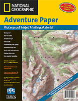
There are several options to get a map off the CD. I’ve tried printing Topo! maps on an ordinary desktop ink jet paper and regular office paper and the results are okay. You get a small, slightly blurry inexpensive map without waiting. It’s good enough for many uses. To make a better homemade map, however, National Geographic sells Adventure Paper, in two sizes, which I recommend. For about $1 per sheet you can print topo maps on a waterproof, untearable plasticized sheet that takes ink jet crisply. Marketed as Teslin, this paper won’t tear, smear, or degrade. Get the larger 11x 17 ($2/sheet) if your printer will handle it. That size gives you enough scope of detail while keeping the sheet small enough to easily fold into your pocket – folding won’t weaken the map. For a transverse of a large area print out a series of pocket-sized maps.
The advantage of printing out smaller maps centered on your interest is so significant that National Geographic offers two other options for those who don’t want to invest into each state’s Topo! CD. The first option is to head to one of about 70 Map Machine Kiosks located around the country in outfitter shops such as REI and L.L. Bean. The Map Machine Kiosk has all the topo maps of the entire US stored online (Alaska, too.) As usual, you select the area you want and the kiosk prints it out, centered on your interest – even if it crosses state lines. The machine dispenses a 13×18 inch Teslin-based map immediately. You can choose to have relief shading or not. In my opinion the clarity, color and size of these maps don’t match paper topo maps, which are slightly cheaper ($8 for a kiosk map vs. $6 for USGS topos). But few map shops have a complete menu of US maps, and too often the area you want is shared by two to four maps, making the proposition of printing out one map very appealing.

The other option is online. NG’s partner web site, Offroute.com, will print a custom map for you and mail it to your place. At the Offroute site you click around a seamless online map generated by the same National Geographic data. Then you order a custom map to be printed. Shaded hill relief is an option. Your choice for printing is paper (crisp detail for a wall) or plastic (waterproof for the field). Also a choice: a selection of three map sizes, one of them very large. The typical 13 x18 is handy at $9. The most popular size for field use is a large 26 x 36 printed on Teslin for $20. Finally, if you want something wow, you can get a very hefty 36 x 50 inch map (either on paper or plastic, $45-60), which will include the equivalent of 9 USGS quad maps. In my experience a map from Offroute, arrives on the third day after ordering.
Now back to the open approach. The chief distributor of USGS online topographic data is Topozone.com. Like other digital cartography companies, Topozone cleaned up the USGS’s scanned data and stitched together the maps into one huge continental digital map. By typing in a location, you can pull up a topo map center on your interest. You can inspect a low-res web version but to download a hi-res version (in other words to do anything else except look at it) you need pay a subscription of $80 per year. This doesn’t exactly encourage casual map making. Indeed, Topozone’s biggest customers are commercial enterprises like cell phone companies and environmental clean up agencies, which need loads of maps each week, and maniacal thru hikers compiling long distance hiking trails.
In any case to print out a map you need a different service, since Topozone deals only with digital data. Mytopo.com specializes in maps on demand — particularly large topo maps on demand. Like Offroute they can print in various sizes, on various types of paper. Unlike the National Geographic data, they do not offer relief shading at the moment. But Mytopo has one huge advantage: their prices are much cheaper. Their largest size topo map is $30 versus $45 for a comparable size, and the popular mid-size $15 instead of $20. They also offer to ship maps folded rather than rolled (no problem for the plastic paper). I got my map from them in 2 days. Compared side by side with Offroute, the quality was a notch lower: colors less subtle and no relief shading.
I find Offroute’s web interface to be the most convenient way to dig up a topo map (in the US). Mytopo’s interface is far less intuitive, and slower. But I sure like their prices better and I’ll take time to fiddle. In either case the online print option makes sense when you want large maps, maps that breech more than one state, and maps from states you don’t plan to visit more than a few times. Purchasing the state Topo! Makes sense when you reside in that state and plan to explore it often, or are part of a outdoor club that can invest into a library of digital maps. (If you were printing out a lot of maps yourself, and had a wide printer, you can purchase Teslin paper in bulk rolls from PGP.) In short, Offroute is the premium service (better interface, fancier output), while Mytopo is the no-frills thrifty provider.
 MapXchange
The second great advantage of National Geographic’s proprietary system is that they have engineered a way for map buyers to annotate topo maps. Users can download their travels via GPS onto maps, and then add comments. Then they can print out their customized maps. This ability to interact has pumped some juice into mapmaking, It is flowing most visibly in the National Geographic’s MapXchange, where folks can swap their annotated maps. Dedicated hikers can post their map additions. For instance, for the week I wrote this, the “download of the week” at MapXchange was a complete trace of the Pacific Crest trail by an amateur cartographer named Tom Reynolds. Reynolds used trail guides to draw the entire hiking route onto the California Topo! Map. He was offering a free GPS unit to any thru hiker who would ground-truth it. Other user-generated maps offered on the exchange: Waterfall hikes in Georgia, photo trails in Utah, mountain bike trails surrounding Santa Barbara. All free for the taking – but you need the Topo software to read and use them. (Bummer.) Currently hundreds of hiking and outdoor clubs are using the software to compile their own maps. I’ve even heard of one national park that started using Topo! And the mapXchange to create their own park map because they couldn’t get headquarters to do it in less than a few years.
The greatest gift of the web is the ability to leverage communities. On the web, enthusiasts not only consume maps, they produce them too. Niche maps (bird spots along the Erie Canal for example) now have immediate and reciprocal niche audiences. The future of mapmaking lies in developing tools that allow maximum participation by any person with passion for maps. The long-term problem of National Geographic is that their system is closed to third party vendors or participants who don’t buy their software. This will inherently limit the adoption of the exchange, as cool as it is. What is likely to come along and overwhelm it is an open source version that allows anyone to download the software, add a level to a map, and then swap it. Just like in music and films where file swapping is rampant, money will be made in selling additional and premium services.
The present is just as exciting. Amateurs are learning the language of mapmaking — the nuances of projection and scale. Someday soon there will be a MapCon, a convention of map fans, fanatical devotees of amateur map making, none of whom are professional, and all of whom are making maps others use.
— KK
National Geographic Adventure Paper
$25 (10 sheets 11×17, ID #: W79-500)
$25 (15 sheets 8.5×14, ID #: W79-400)
$25 (25 sheets 8.5×11, ID #: W79-100)
Available from National Geographic
Or $40 from Amazon (currently unavailable)
Teslin Sheets
Manufactured by
PGP
National Geographic Maps
TOPO
800-962-1643